|
TRADES WINDS & CURENTS
Please use our A-Z INDEX to navigate this site where page links may lead to other sites
|
|||||||||||||||||||||||||||||||||||||||||||||||||||||||||||||||||||||||||||||||||||||||||||||||||||||||||||||||||||||||||||||||||||||||||||||
Solar Navigators (those sailors with solar powered boats) should take advantage of trade winds and ocean currents wherever practical by way of an eco compromise route, whereas a steam or diesel powered vessel takes the shortest route to its destination.
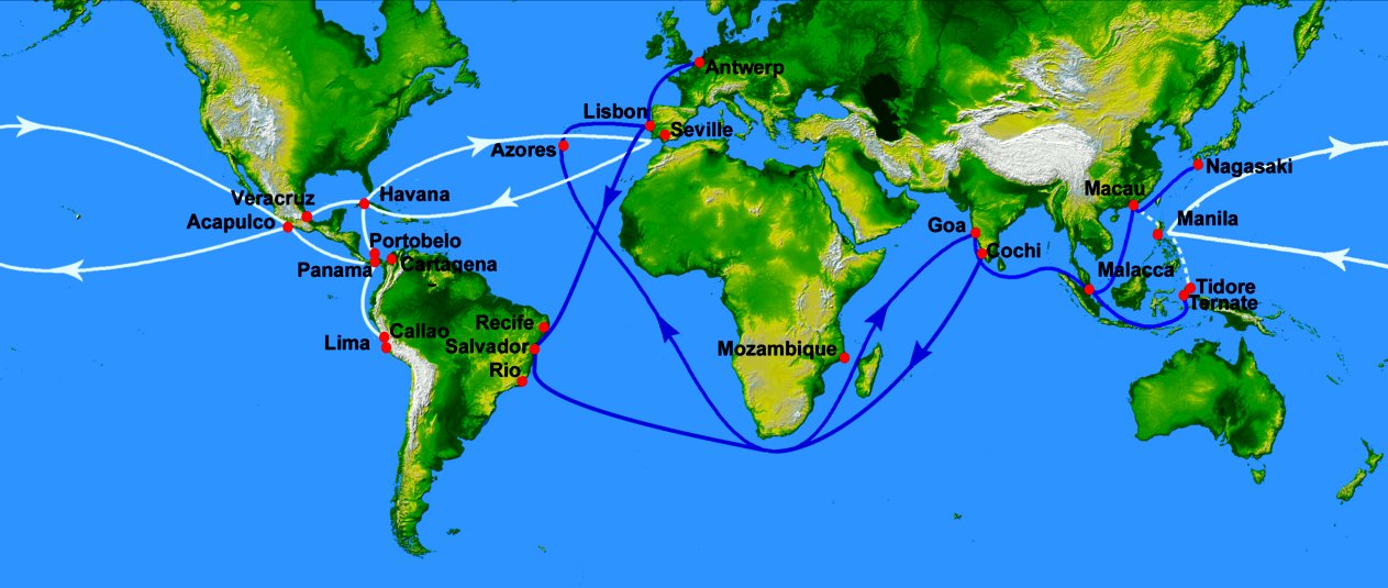
Navigation is easier for powerboats, whereas the early European explorers had to discover the pattern of winds and currents that would carry them where they wanted to go. During the age of sail winds and currents determined trade routes.
With a solar and wind powered vessel it makes sense to use natural forces wherever possible. That said, the Elizabeth Swann does not need to tack to take advantage of the wind, where turbines act a rotary sails, compensating for the vector. The efficiency is though greater with following wind.
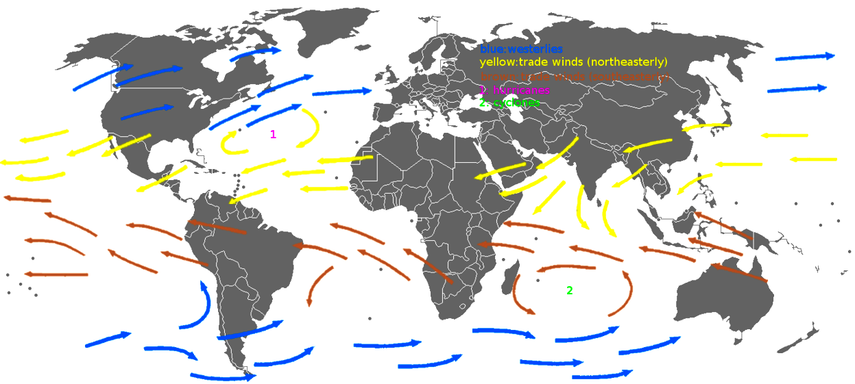
THE TRADE WINDS
The trade winds and associated ocean currents helped early sailing ships from European and African ports make their journeys to the Americas. Likewise, the trade winds also drive sailing vessels from the Americas toward Asia. Even now, commercial ships use "the trades" and the currents the winds produce to hasten their oceanic voyages.
Between about 30 degrees north and 30 degrees south of the equator, in a region called the horse latitudes, the Earth's rotation causes air to slant toward the equator in a southwesterly direction in the northern hemisphere and in a northwesterly direction in the southern hemisphere. This is called the Coriolis Effect.
As the wind blows to about five degrees north and south of the
equator, both air and ocean currents come to a halt in a band of hot, dry
air. This 10-degree belt around Earth's midsection is called the Inter-Tropical Convergence Zone, more commonly known as the doldrums.
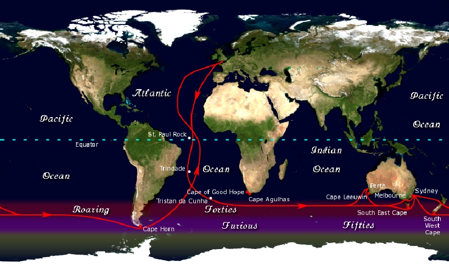
THE CLIPPER ROUTE
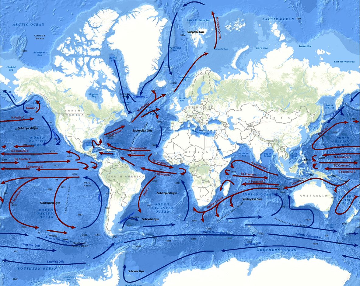
OCEAN CURRENTS
Currents travel around 5.6 miles per hour in warmer waters of the northern hemisphere and in the North Pacific moves much slower in cold water at 0.03 to 0.06 miles per hour.
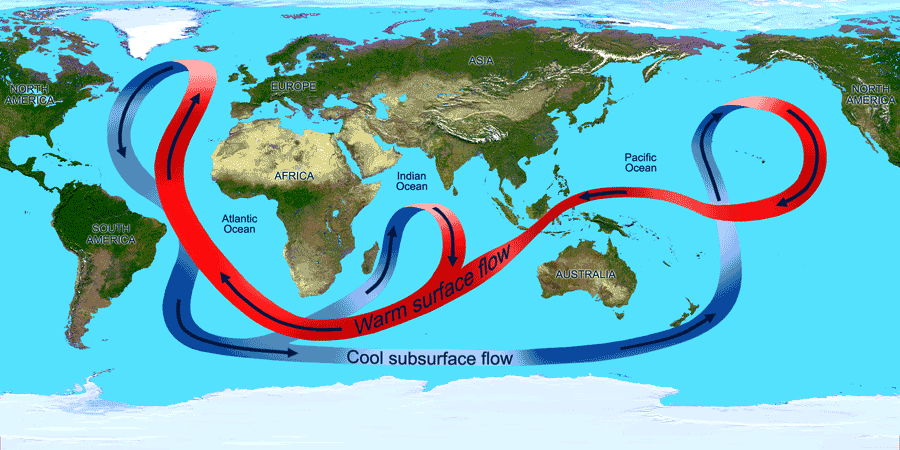
To understand the effects of winds on ocean currents, one first needs to understand the Coriolis force and the Ekman spiral.
Winds Drive Surface Ocean Currents
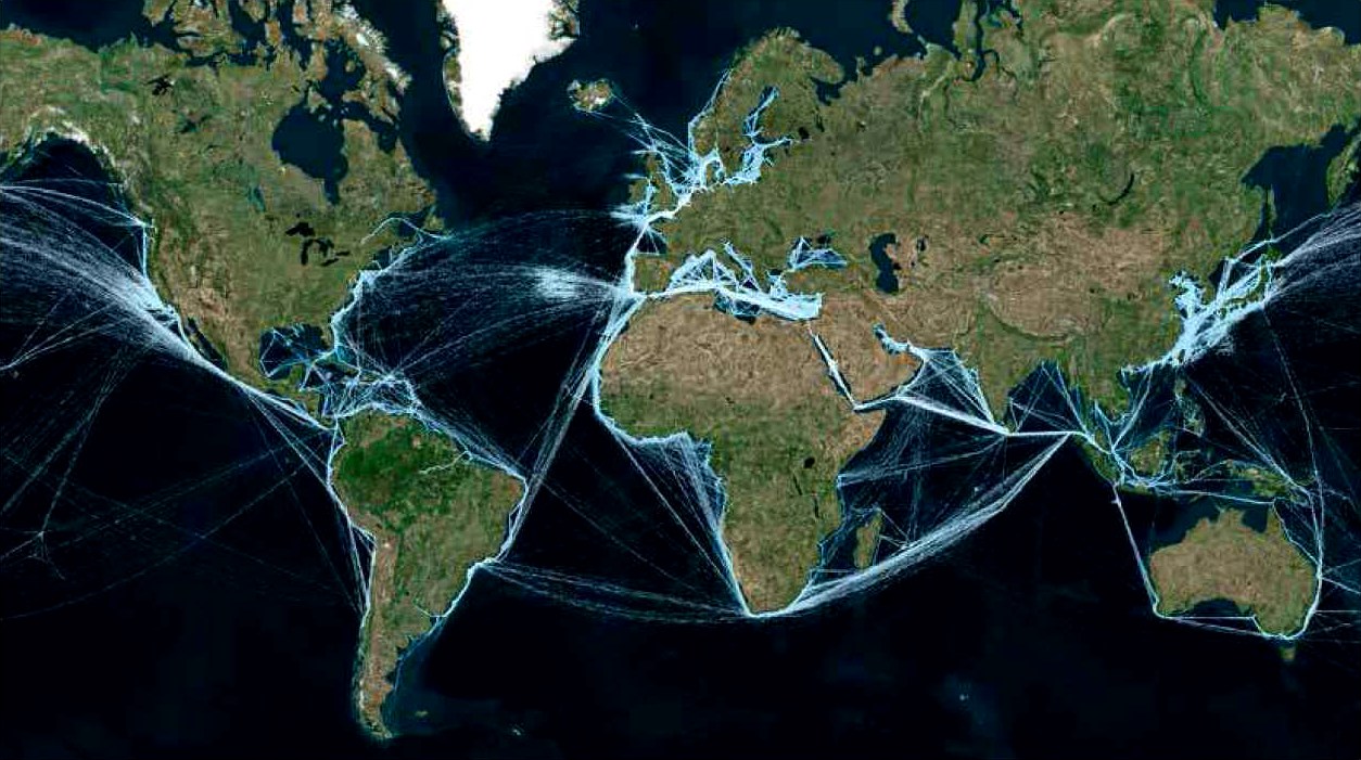
NIGHT LIGHTS - The above satellite map of world routes shows the trade routes most used by modern cargo and passenger vessels.
Ekman spiral
Like the surface water, however, the deeper water is deflected by the Coriolis
effect - to the right in the Northern Hemisphere and to the left in the Southern Hemisphere. As a result, each successively deeper layer of water moves more slowly to the right or left, creating a spiral effect. Because the deeper layers of water move more slowly than the shallower layers, they tend to “twist around” and flow opposite to the surface current.
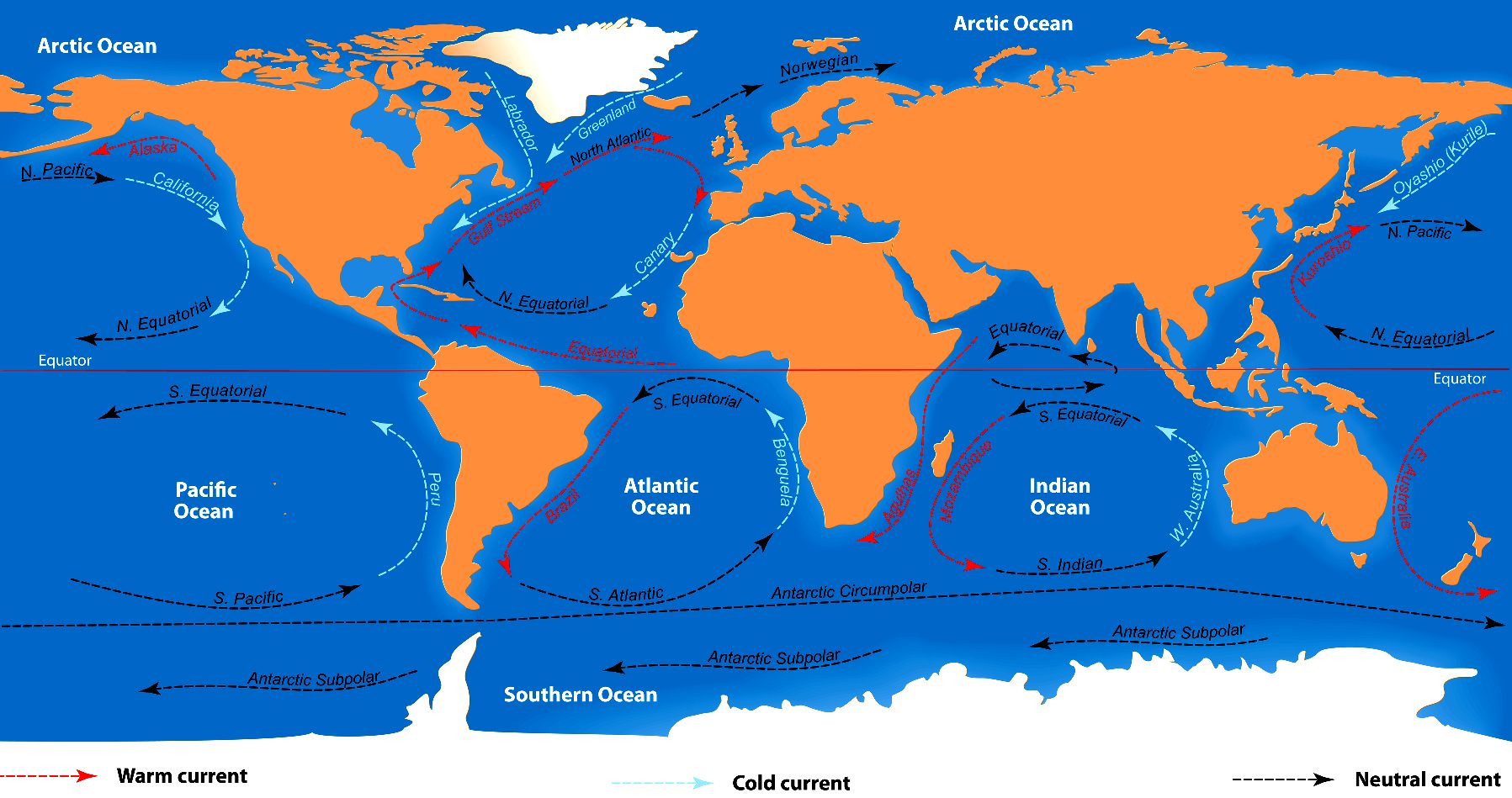
GLOBAL CONVEYOR BELT
RECORD "SUNSHINE" ROUTE
CLIMATE CHANGE CHALLENGE - The above table illustrates one of the most likely ocean awareness expedition routes, known as the 'Sunshine Route,' showing the time elapsed in days for 7 knots average cruising speed, including times for 5 and 6 knot averages - allowing for 10% downtime and 36 days in ports. Hence, although the objective is to reduce the current solar circumnavigation record from 584 days, the event in not an outright non-stop yacht competition in the offshore racing sense. It remains to be seen how accurate such a prediction might be. In this table we only allowed 36 days for provisioning and PR but added a 10% contingency for servicing, that could be used for additional time in ports. As a Climate Changing event, performance is one of the main criteria, especially concerning the possibilities for a transition to low carbon shipping and the contribution this might make in combating global warming. UK project team.
CONTACTS
Cleaner Ocean Foundation & Bluebird Marine Systems Ltd Solar Studios BN271RF United Kingdom growth@blue-growth.org
LINKS & REFERENCES
https://oceanservice.noaa.gov/facts/tradewinds.html http://www.blue-growth.org
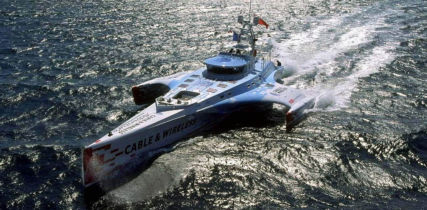
STABILIZED MONOHULL - The diesel powered Cable and Wireless Adventurer was built for the purpose of circumnavigating the world in less than 80 days. This was successfully accomplished in July 1998 in 74 days, 20 hours, 58 minutes, traveling more than 22,600 nautical miles (26,000 miles or 41,855 km). This achievement set a new Guinness World Record for a diesel powered vessel. The nautical mile or knot, is a unit of speed equal to approximately 1.15078 miles per hour on land (1.852 km).
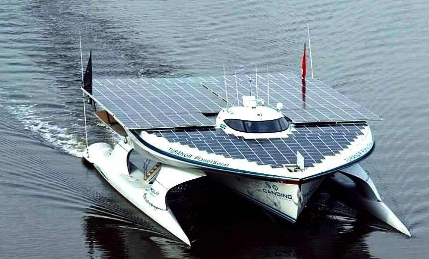
GUINNESS BOOK OF RECORDS - MS Turanor PlanetSolar (Switzerland) navigated the world in a westward direction from Monaco in 1 year 7 months and 7 days from 27 September 2010 to 4 May 2012. We wonder why nobody has attempted to improve on this design, to challenge the record in the intervening seven years.
Please use our A-Z INDEX to navigate this site
|
|||||||||||||||||||||||||||||||||||||||||||||||||||||||||||||||||||||||||||||||||||||||||||||||||||||||||||||||||||||||||||||||||||||||||||||
|
This website is provided on a free basis as a public information service. copyright © Climate Change Trust 2019. Solar Studios, BN271RF, United Kingdom.
|